Agri-EPI seeks to bridge the gap between the people creating innovative new agriculture technologies, and those who benefit from them.
Established as part of the UK Government’s Agri-Tech Strategy to develop, fund, and commercialise new precision agriculture technologies, we exist to facilitate collaboration between researchers, start-ups, investors and farmers to bring the latest agri-tech innovations to reality.
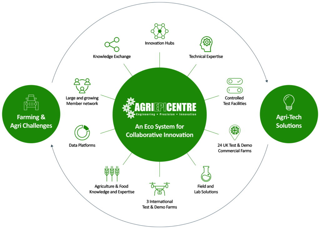
We at Agri-EPI have a strong network of contacts globally, and facilities across the United Kingdom, with a proven track-record of taking new ideas from theory to practice, in a way that honours our two core goals: maximising profitability of the supply chains that feed the world.
Our carefully-crafted ecosystem of agricultural innovation takes aim at the most challenging real-world farming and agricultural problems, stress-testing and then demonstrating the viability of new solutions that benefit not just the industry, but the world at large.